Showing posts with label Salt Lake City. Show all posts

Tuesday, June 19, 2012

Lake Blanche 2012

Sundial Peak is so Beautiful

This lake never gets boring. The beauty is never ending. We did this hike a year ago (16 June 2011) and ran into piles of snow. This time around the trail was much easier to follow and we were able to take our time and marvel at the sites around us. 

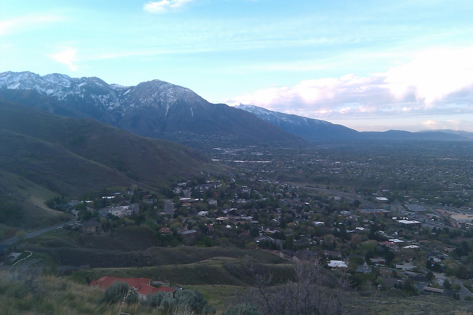
The trail starts at the Mill B trailhead up Big Cottonwood Canyon. From the parking area on the South side of the road head east along a paved path about a 1/4 mile. The trail then heads south up a steep incline to the south. This small climb then levels out and crosses over the Mill B South fork of Big Cottonwood Creek. After crossing the creek the trail heads north for a bit as it gains a little elevation and then switches back to head south. The trail follows the creek much of the way up the canyon till you make it to the final approach the trail then goes East up a few switchbacks. 

As the trail makes its way past the final switchback and makes its way to the lake there are many markings on the rocks that people have made as they visited the lake some dating back to the  early 1900's (if they are legit). We saw a few markings from 2012, it is sad that people do this still. Because lake Blanche is in the Twin Peaks wilderness area all visitors should use "Leave No Trace" principles in order to preserve the beauty of the area.
 Around the lake there is a rock wall this part of the old Dam that was used before the Twin peaks wilderness area was created. Below Lake Blanche there is also Lake Lillian and Lake Florence. These two sister lakes also offer peaceful views and beauty. 


Normally on or hikes we try to stick to a time frame because we have to head to work right after but as we hiked around the lake and took everything in our time frame went out the window and we spent about an hour just hanging around the lake.    
Joel and his brother Bret hanging out by the old dam.

This is a comparison photo of our 2 hikes to lake Blanche


View Lake Blanche in a larger map

Tuesday, June 12, 2012

Bowman Fork (Millcreek Canyon)

Our original design as we set out at 6:30 in the morning was to hike Mount Aire (a peak behind Grandeur Peak) up Millcreek Canyon. As we drove up the canyon we were disappointed to find out the gate to the upper part of the canyon was still closed. I guess it never opens till July 1st even though we haven't had much snow this year. So we decided to find a random trail and follow it. 

The trail we ended up on was the Bowman fork trail. The trail head is found at the Terraces Picnic area. The picnic area is found about 4.5 miles up the canyon on the south side of the road. From the Bowman Fork trailhead, the trail begins a gradual ascent as it heads in a generally eastward direction for approximately 1 mile up the Bowman Fork drainage.  From there the trail leaves the drainage and turns to the south. After a series of switchbacks the trail arrives at a beautiful overlook towards Mount Raymond and the Mount Olympus Wilderness Area. 


After exploring the area for a while we continued onward. From the overlook the trail headed east again. According to our map we were supposed to run into a fork in the trail that would head over to the Porter Fork Trail. After searching for the other trail we decided to abandon our efforts and turn around. The map we had showed the trail heading towards a pass between Gobblers Knob and Mount Raymond.

Where Are We?

A Super Gnarly Tree we found 

Tuesday, May 22, 2012

Grandeur Peak (from the west)

I have hiked Grandeur Peak many many times over the years but always from church fork. This time we attempted to access it from the west side. There are 3 main trails approaching from the  west. All three options start from the Bonneville Shoreline trail.   The option we choose starts up the ridge further to the north and closest to I-80.  

View of I-80 from along the trail.
Once the trail reaches the top of the ridge it makes a very steep climb to the south where it joins the middle trail. From the trail merge the peak is in view and the climb is very steep. Overall the trail is much more difficult than the Church Fork route. Due to the fact that I need to take too many rest stops we didn't make it all the way to the summit this time. We will have to return later to finish the job.

Beautiful wildflowers along the trail.

Joel pretending he is fat.


After making the decision to turn around we decided to come down the middle trail. This option appeared to be a little more steep and also a little shorter. I can tell you honestly me knees and thighs were quite sore after this decent.
View towards downtown Salt Lake from where we turned around

Getting There:
 From the stop light at 3300 South and Wasatch Boulevard head east to stay on Wasatch Boulevard.   Wasatch Boulevard immediately turns north and parallels I-215.  Follow Wasatch Boulevard to its end where there is plenty of parking.  From the end of Wasatch Boulevard walk up the dirt road and take the first right fork.   The dirt road heads towards the mountain.  To the left (north) is the first ridge from Parleys Canyon.  In the gully formed by the first and second ridge south of Parleys Canyon, there is a well-maintained trail leading up the bottom of the gully.   This is the best route for climbing the West Ridge.  The trail follows the gully and than cuts left to the ridge top and a view of Parleys Canyon.  From the Parleys Canyon viewpoint the route is a well-used hiker made trail which follows the steep ridge to the summit.


View Grandeur-west in a larger map

Monday, April 30, 2012

Desolation Trail to Salt Lake Overlook


The Desolation trail is a 17.5 mile (one way) trek that starts in Millcreek Canyon and ends at Desolation lake. Although I would have loved to have hiked the whole thing time would not permit. Our destination was a Valley overlook about 2 miles from the trailhead. The trail starts to the west of  the parking area. After a short distance the trail forks with the Desolation trail heading to the right and the Thayne Canyon trail going left.


The first part of the trail is very wooded and offers a lot of shade. after about a 1/4 mile you hit the first set of switchbacks. The trail was fairly easy but had a very steady elevation gain. After the first set of switchbacks the trail heads back to Thayne Canyon where the Two trails meet up again. (We took the Thayne Canyon trail on the way down.) Desolation trail then heads west and gradually makes its way up the mountainside. There is one switchback before a longer stretch of the trail  takes you to the last set of switchbacks that takes you over the ridge line to the Valley overlook.


First look at the valley 

A view of Grandeur Peak to the north


The desolation trailhead is located at the South Box Elder Picnic area, 3.2 miles up the canyon just east of the Millcreek  Inn.

View Salt Lake overlook-Thayne Canyon in a larger map

Monday, April 23, 2012

Jack's Mountain Mailboxes


 In 1995 Jack Edwards died of leukemia. His parents went to a peak above Salt Lake and scattered his ashes. There are two mailboxes that mark the site, with a notebook that begins with a letter from Jack’s mother: "Please take a moment to say hello to Jackie Jack and write a little (or long) note." The mailboxes now contain several journals (we counted 14) filled with personal and poignant entries by visitors from the past.
A view to the south as we head up the rigeline

The trail starts at the Bonneville Shoreline trailhead on Lakeline Drive, southeast of the “H”Rock. Take the Shoreline Trail west about 0.3mile, just past a brown post, to a footpath that goes north into an oak grove and makes a short, steep climb to the top of the H Rock. There are several trails to the ridge above; the easiest continues northeast 500 feet to a hard right turn. Go another 500 feet to the ridge trail. Go left along the ridge to the communication tower. There, the trail goes downhill briefly and then up, up, up northeast. Jack’s Mountain peaks 1.6miles from the trailhead. The mailboxes are just north of the summit. 

A view back down the trail                                              Skittles

Writing in the journals.
Please, do not disturb the memorial except to read and write in the notebooks.
This hike offers wonderful views of the city


For directions to the trailhead click here.

View Larger Map

Tuesday, June 21, 2011

Neffs Canyon

Neffs Canyon is one of my favorite hikes.
We hiked this trail on June 21st 2011, normally most the snow would be gone by then but, due to a very wet spring, we had to do much of the hike in snow. As we usually do we began early (around 6:30) the trail is very well maintained and easy to follow. Because of all the snow and excessive runoff we had quite an adventure trying to find our way around parts of the trail that were flooded.  The hike is moderate with the last .25 mile or so becoming strenuous. Much of the hike is through the Mt. Olympus Wilderness area. We stopped at the meadow, the trail continues from there and can be a great way to explore the many trails in the wilderness area.


Total Distance: 3.4 mi 
Total Time: 2:42:06
Moving Time: 1:15:25
(one way) 6.8 miles round trip


Max Speed: 11.67 km/h (7.3 mi/h)
Min Elevation: 1685 m (5528 ft)
Max Elevation: 2385 m (7826 ft)
Elevation Gain: 876 m (2874 ft)
Max Grade: 5 %
Min Grade: -1 %
Recorded: Tue Jun 21 06:30:02 MDT 2011


View Neffs Canyon 6-21-11 in a larger map

Tuesday, June 7, 2011

Grandeur Peak from Church Fork


Click to enlarge panorama atop Grandeur Peak


Grandeur Peak from Church Fork
Church Fork is the easiest and most accessible trail-head to hike Grandeur Peak. The trail head is at the end of the Church Fork picnic area about 3.2 miles up Millcreek Canyon on the North side of the road. if you reach the Millcreek Inn you have gone to far. For directions click here. The gates to the picnic area are open from 7 am til 10 pm during the summer. On the day of our hike the gates were closed do to excessive spring runoff in the canyon. If the gates are closed hike the additional 1/4 mile through the picnic area. The trail-head is well maintained and there is parking available. Don't park in the picnic area.


Extra spring runoff flowing from church fork


The beginning of the trail is a moderate hike through a heavily forested area of the canyon after a short distance it intersects with the Millcreek Pipeline trail, make sure you continue heading north across the other trail. The trail is very easy to follow until you get closer to the peak. A little over a mile into the hike the trail turns to the left and climbs out of the wooded area through a series of switchbacks. The surrounding area is now primarily scrub oak and exposed rock. There are a few areas on the trail where the rock has slid onto the trail but it is easily navigated. About 2 miles into the hike you reach the ridge looking over into Parleys Canyon. From here the trail heads Southeast toward the summit, about a 1/2 mile away. The climb gets a little more difficult and heads up a false summit. After the false summit the trail then goes around to the west side of the mountain, although there is a path up the more difficult east side. The final ascent has some very minor scrambling but is less than difficult.


Bret (in the bushes) and Joeh on ridge just before the final stretch


The peak offers wonderful views of the Salt Lake Valley to the West Mt. Olympus directly to the South, Emigration Ridge directly North and Mt. Aire to the East. The return trip is back along the same trail. The only problem we encountered was for some reason our GPS didn't log the hike correctly. Thankfully because of the many times I have hiked this trail I know that the total distance round trip, from the road, is 7 miles. it took us less than 2 hour to get to the top and about an hour and ten minutes to get back down.


Click here for a larger map: Grandeur

Total Distance: 6.9 mi
Total Time: 3:33:01
Moving Time: 3:07:28
Average Speed: 4.83 km/h (3.0 mi/h)
Average Moving Speed: 6.54 km/h (4.1 mi/h)
Max Speed: 10.80 km/h (6.7 mi/h)
Min Elevation: 1730 m (5676 ft)
Max Elevation: 2523 m (8278 ft)
Elevation Gain: 984 m (3229 ft)
Max Grade: 19 %
Min Grade: 0 %
Recorded: Tue Jun 07 06:32:25 MDT 2011
Activity type: -

Wednesday, May 25, 2011

Little Black Mountain


Click to enlarge panoramic view


Little Black mountain is located Northwest of Downtown Salt Lake City and is easily accessed from the Salt Lake Avenues. There are many trail-heads that will lead you to the mountain (as long as you are headed in the right direction). The trail-head we chose is located on Richland Dr. just off of North Bonneville Dr. located in the Salt Lake Avenues. For Directions to Richland Dr. click here.

The first part of the trail starts out up a well traveled hill very popular with mountain bikers. After descending the first hill there is an intersection of trails, continue heading East up a small ridge and then turn to the left and follow the ridge to the top of the hill. This is the first "Hill" along the ridge that heads to Little Black. After each hill the trail descends slightly and then climbs up higher with then next one. The second hill top also leads to the Avenues Twin Peaks. To summit Twin Peaks continue heading south up to the top of the first Twin Peak. Twin Peaks has some nice views of the Salt Lake Valley but not nearly as breathtaking as Little Black.


Looking towards Little Black Mountain


View from one of the Avenues Twin Peaks


Head back to the Northeast and continue along the ridge toward the final destination. There are a few more small climbs till you get to the final climb up to the top. The last mile or so is quite difficult as you make your way to the summit. Once to the top take a look around the view extends North from Ogden and Ben Lomond Peak all the way South to Utah Lake and Mount Timpanogos, From the Uinta Mountains to the East with Deseret Peak and the Great Salt Lake to the West.


Snowy final stretch


Joeh on his way up the last bit of steep terrain

It took us a while to catch our breath before heading back down. Don't forget to sign the register at the top. If you want more of a hike the ridge continues on to Lookout Peak, we decided to turn around. On the way back there are several branches in the trail that head back to various trail-heads. We missed the trail that brought us up the mountain and ended up heading down "The Bobsled" which is a popular mountain bike trail. The Bobsled trail was more step with many curves, fun for bikers, it made us glad we were going down the trail as it would have been a difficult climb up. The total trip took us just under 4 1/2 hours and we hiked for about 9 miles round trip.

Geological Benchmark (no elevation engraving)


Geocache register


View Little Black Mountain 5-25-11 in a larger map


Total Distance: 15.56 km (9.7 mi)
Total Time: 4:25:56
Moving Time: 3:21:21
Average Speed: 3.51 km/h (2.2 mi/h)
Average Moving Speed: 4.64 km/h (2.9 mi/h)
Max Speed: 11.91 km/h (7.4 mi/h)
Min Elevation: 1564 m (5132 ft)
Max Elevation: 2376 m (7794 ft)
Elevation Gain: 1167 m (3830 ft)
Max Grade: 1 %
Min Grade: -2 %
Recorded: Wed May 25 06:46:23 MDT 2011
Activity type: - Hiking

Thursday, May 12, 2011

Emigration Ridge Line Trail


Click Image for panoramic view

Although the original intent was to climb to the top of Perkins Peak starting from the West and following a small and poorly marked ridge-line trail, our plan was spoiled by the abundance of "no trespassing" signs and "intruders will be prosecuted" signs found at what we thought to be a perfectly good trail head. We instead drove to the summit of Emigration canyon and started the trek from there. The trail starts from the south side of the road and when you get above the dirt parking lot you are able to see two of the higher points along the ridge-line trail. This hike was much different than any of the previous hikes in that the beginning seemed to have as much down hill as it did up hill as the trail made its way along the ridge. after the first few peaks and valleys the trail turns from an old double track jeep trail to a progressively steeper single track game trail. after you reach the top of the first large summit "the beast" (informally named by me) the second is a much more manageable climb to the top.


up "the beast" the first of two large summits


The trail has a continuous view of both Parleys canyon and Emigration canyon and there is a constant hum of the distant traffic from I-80. When you reach the higher of the two peaks there are 360 views to Salt Lake City, Mt. Wire, Mt Olympus, Grandeur Peak, and panoramic views to the surrounding snow topped mountains.


View of the last stretch along the snowy ridge


We turned around at the second peak, however the trail continues along the ridge-line and eventually takes you to a couple higher peaks before dropping back into the valley between Emigration and Parleys canyons.(if you are sneaky enough maybe you can get off the west end of the trail without being prosecuted)


View Emigration ridge-line 05-12- 11 in a larger map


Total Distance: 12.34 km (7.7 mi)
Total Time: 2:33:42
Moving Time: 1:57:55
Average Speed: 4.82 km/h (3.0 mi/h)
Average Moving Speed: 6.28 km/h (3.9 mi/h)
Max Speed: 10.06 km/h (6.3 mi/h)
Min Elevation: 1817 m (5961 ft)
Max Elevation: 2243 m (7358 ft)
Elevation Gain: 733 m (2404 ft)


Thursday, May 5, 2011

Mt. Wire (Big Beacon)


Mt Wire has many access points the trail we decided to hike I would suggest is the easiest to the top. The trail-head is located just off the Bonneville Shoreline trail (BST). Parking can be found along Colorow Rd. behind Fort Douglas near the University of Utah. (check the map for directions)


 The Trail has a few different sources that all stem from the BST. We accessed the BST just to the north of The Huntsman Corp. headquarters along a small creek bed for spring runoff there normally is not much water along the trail, be sure to bring plenty of your own. The trail heads to the East directly behind the Huntsman building. the first part of the trail has a gradual climb in elevation after about a 1/2 mile the trail makes a turn to the north and becomes more steep. The majority of the climb is along a canyon on the north west side of the mountain the trail is engulfed by scrub oak which can keep the trail nice and cool especially on a early spring morning. The top of the canyon is about 3 miles into the hike the trail then turns to the Southwest and climbs up the first of three ridges the third and final ridge is the top of Mt. Wire. At the top there are wonderful views of downtown Salt Lake to the West and South, Mount Van Cott to the Northwest, Emigration Ridge to the East, and Grandeur Peak to the Southeast.


For the hike down we choose to descend the Southwest side of the mountain. This route is much more steep and more strenuous. Beginning hikers should take caution, don't be in a hurry one false or rushed step could cause injury.  The trail down branches in many directions but by staying to the right at each fork you it will lead back to the BST not far from where the trail began.
Some of the Hiking Statistics:

Total Distance: 11.63 km (7.2 mi)
Total Time: 3:14:34
Moving Time: 1:42:53
Average Speed: 3.59 km/h (2.2 mi/h)
Average Moving Speed: 6.79 km/h (4.2 mi/h)
Max Speed: 10.80 km/h (6.7 mi/h)
Min Elevation: 1510 m (4955 ft)
Max Elevation: 2171 m (7123 ft)
Elevation Gain: 832 m (2730 ft)

Hike to Mt Wire (Big Beacon) 5-May-2011


View Mt Wire Hike

Thursday, April 28, 2011

Mount Van Cott loop hike

       We did this hike on April 28th it was a fairly cool day but warm enough for this nice spring hike. The trail-head is located on the North side of Red Butte Gardens near the University of Utah.  Parking can be found on the south side of Red Butte Canyon Rd. right before the gate.
      The trail-head is across from the parking area on the north side of the road. the first part of the trail can be a little confusing because there are many trails along the foothills. If you stay to the right at each fork you will continue up the canyon parallel to Red Butte Canyon Rd. (behind the gate) After about 1/2 mile the trail veers to the left and starts a steeper climb up the mountain. The climb is still fairly easy. There are 2 gradual switch backs on you way up the trail, after the second you approach a false summit. After the false summit the climb to the top of Van Cott is a little more difficult but manageable (even for a beginner or out of shape hiker). Once reaching the top the views are wonderful. To the West and South is downtown and the whole Salt Lake Valley, to the North is Grandview Peak and to the Southeast is Mt. Wire and Mount Olympus.


       At the top there a many intersecting trails don't forget to head to the right (NE) where there is a pile of rocks marking the highest point of the peak. Instead of heading back the way we came we opted to head down the west side of the mountain, This gave us some different views and some better looks at Downtown Salt Lake and the University of Utah. The trail down was a little shorter and offered a little more shade which I'm sure would be nice on a hot summer day. After reaching the bottom of the mountain head Southeast along the Bonneville Shoreline Trail for a little less than a mile back to the trail-head and parking area. The total 4.7 mile hike took us 2hrs 15min. at an average speed of 3.4 MPH. The hike can be done much quicker, but I figure it's better to take your time and enjoy the hike.

For more information and a trail map click on the link below.

View Mount van Cott 4-28-11 in a larger map
Mount Van Cott loop hike


Total Distance: 7.61 km (4.7 mi)
Total Time: 2:15:38
Moving Time: 1:32:50
Average Speed: 3.37 km/h (2.1 mi/h)
Average Moving Speed: 4.92 km/h (3.1 mi/h)
Max Speed: 9.00 km/h (5.6 mi/h)
Min Elevation: 1524 m (5000 ft)
Max Elevation: 1928 m (6325 ft)
Elevation Gain: 531 m (1741 ft)
Max Grade: 0 %
Min Grade: 0 %
Recorded: Thu Apr 28 06:54:03 MDT 2011
Activity type: -