Showing posts with label Sandy Utah. Show all posts

Monday, May 14, 2012

Mill B North and Hidden Falls


The Mill B North Trail Starts up Big Cottonwood Canyon. About 6 miles up the canyon in the middle of the S curve is the parking area. To the South of the road is the more popular Lake Blanche trail . The Mill B North Trail head is on the North side of the road near the top of the S curve. This trail is more often uses to access Hidden falls that is just a short distance from the Road.

The trail forks almost immediately after crossing the road. The trail to the left goes to the falls and the trail to the right heads up several switchbacks to the top of the hill above the falls. From here the trail follows the stream above the falls for a little while before turning to the right and climbing slightly steeper. After two long switchbacks the trail makes its way to the first overlook above Big Cottonwood.

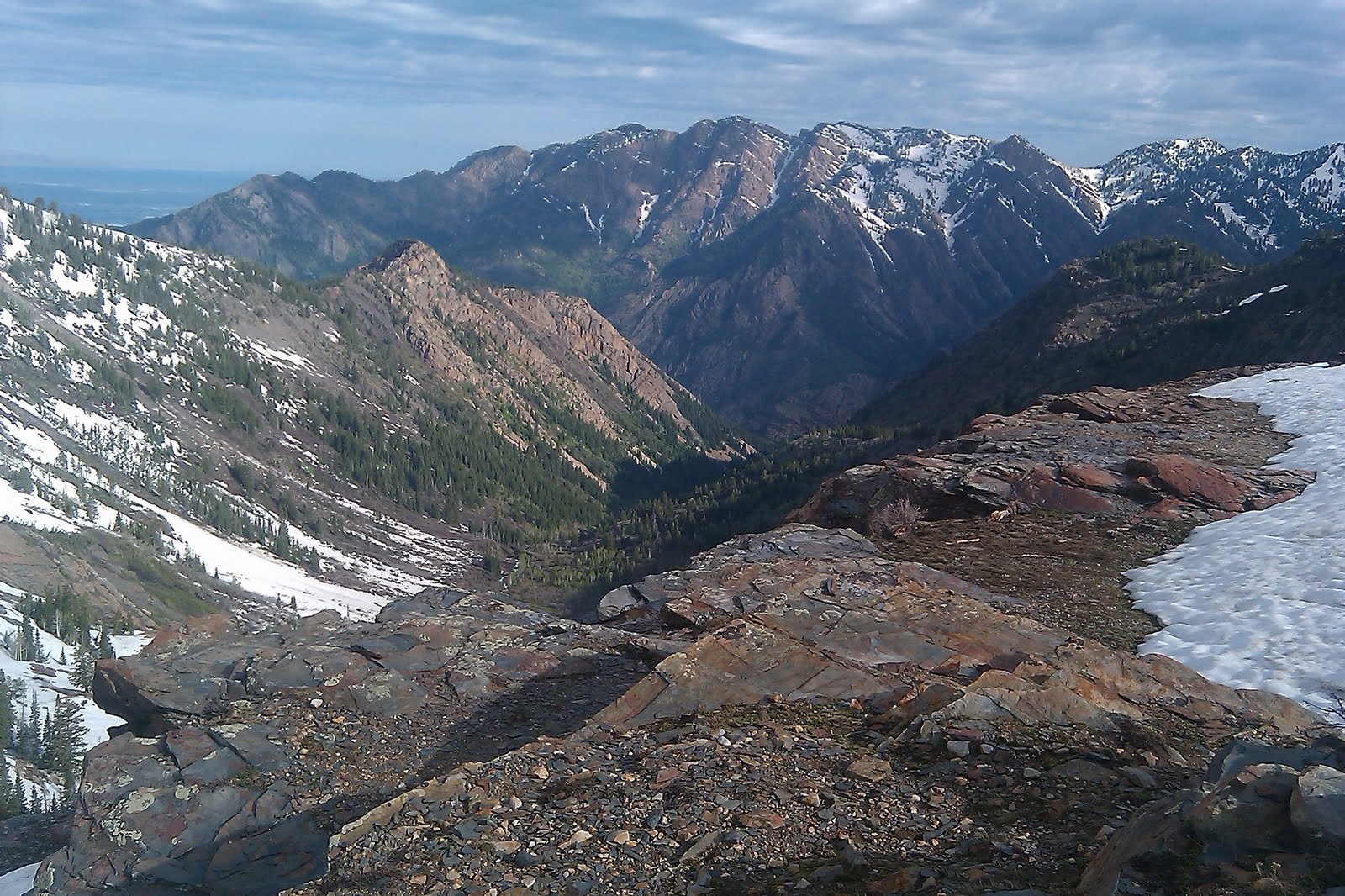
View up the Canyon from the canyon overlook


Joel on the trail
After the overlook the trail heads to the northeast along the ridge between the Mill B fork and Porter fork canyons. We stopped at an overlook above Porter Fork directly beneath Mount Raymond. The trail continues on and provides access to Mount Raymond and Gobblers Knob eventually making its way down the other side of the mountain into Millcreek Canyon. 

Taking a rest at the top of Porter fork.


On the way back down we stopped off at the falls. Hidden falls is truly a beauty. I wonder how many people travel up and down the canyon without ever seeing it.


View Mill B Trail in a larger map

Tuesday, May 8, 2012

Ferguson Canyon

Ferguson Canyon is a little know canyon near the mouth of Big Cottonwood Canyon. The trailhead is a little difficult to find This is the description we followed: Follow directions to the mouth of Big Cottonwood Canyon. There is a 7-11 store here, at the intersection of Wasatch Blvd (Hwy 210) and Fort Union Blvd (Hwy 190, also 7200 South). From this intersection, head south on Wasatch Blvd for a quarter mile and turn left (east) into the Prospector Drive neighborhoods. Take an immediate right and head south up the hill. Take the second left onto Timberline drive and park alongside the right side of the road near the trailhead sign. A dirt road leads to a white water tower and then turns into a trail that descends into the canyon. Follow various branching trails east into the mouth of the canyon.
View back towards the Valley from the water tower

The Trail mainly follows the stream up the canyon. The first part of the canyon is surrounded by huge rocks and boulders, I would imagine it is a popular climbing spot.


We also found many old and interesting trees along the trail.


After about 1.5 miles the trail leaves the stream and heads up the mountain to the east to an overlook spot. This is where our journey ended for the day. I believe the trail does continue up to the top of storm mountain. We may have to come back and travel to trail a little further in the future.

Joel at the overlook
This was my favorite picture of the hike, an old tree perched at the top of the lookout area.

View Ferguson Canyon in a larger map

Tuesday, June 28, 2011

Beartrap Fork - Big Cottonwood Canyon


Beartrap fork is located up Big Cottonwood Canyon. to get to the trail head go east on  Big Cottonwood Canyon Rd.(7200 S.) 10.5 miles up the canyon past the spruces campground. The trail head is on the North side of the road, there is a small gate in front of an old access road, the trail starts behind the gate.
Click here for directions to the trailhead. 


The first part of the trail is a little difficult to follow it follows an old jeep trail with a couple of switchbacks and then intersects with another old jeep trail. Stay on the main path and you should make your way to the first stream crossing. We found the water running really high and fast so be careful as you cross. the trail then heads up the canyon mainly following the stream.
One of the many Stream crossings

Joel crosses an old dead tree


Ski lift from the Canyons Ski Resort in Park City

A view of Park City from a distance

A Beautiful view of the Ridge dividing Salt lake and Summit counties


View Beartrap Fork in a larger map

Thursday, June 16, 2011

Lake Blanche

Frozen Lake Blanche covered in snow, rare for June.

The Lake Blanche trail starts about 4 miles up Big Cottonwood Canyon. Parking is on the right side of the road just before the "S curve" at the Mill B parking area. On our way up the Canyon we saw a large moose standing right next the road blocking our turn into the parking area. We waited for him to cross the road and proceeded to the trail-head. What a great way to start of the morning.

For Directions to the trail-head click here.
The Stream was flowing high

The trail starts on the East end of the parking lot and follows the Creek on a paved walkway for the first 1/4 mile. The trail  splits off to the right just before a bridge that crosses over the creek that flows down from the lake.  The well maintained dirt trail to Lake Blanche begins on the west side of the bridge and is signed.  From here the trail is easy to follow and leads directly to the lake. The trail is a very manageable climb for an intermediate Hiker until the final climb before the lake.  The last 1/2 mile is a little more difficult especially for us because the ground was covered in snow. When we arrived at the lake we found it frozen and covered in snow. Located just to the west of Lake Blanche is Lake Florence and Lake Lillian. 
Looking back down the trail towards Mount Olympus.


The setting around Lake Blanche is Beautiful, the perfect alpine setting. We found complete solitude which isn't normal for this time of year. 
 (I did this hike on 19June2009 and it was crowded on the way down the trail.) As I sat down to take in the scenery and enjoy a granola bar I was greeted by a few Potguts (ground squirrels) that seemed to know what I was eating. I guess they are no strangers to human interaction.


 One of the great draws of the lake is the abundant wildlife and today was now exception in addition to the moose at the trail-head we also had a close encounter with one on the trail. The 2nd moose stood up about 15 feet away from us  as we headed up the trail. We also saw mule deer and many birds, I'm sure this hike would be a bird watchers paradise. 


Sundial Peak above lake Blanche
Overall distance on the hike was just over 6.5 miles round trip we had a total hiking time of 4 hours maybe 3.5 of that actually moving. The map below is of the Mill B trail-head up Big Cottonwood Canyon.


View Larger Map

Friday, June 10, 2011

Bells Canyon Waterfall

Bells Canyon is a wonderful hiking spot easily accessed from Sandy, Utah. There are 2 main trail-heads on located on Wasatch Blvd. about 10200 south. Click here for directions to this trail-head. Parking is on the East side of the road and the trail starts at the north end of the parking area. The second trail head is off Little Cottonwood Canyon Rd. Click here for directions to this trail-head. The parking for this trail is located on the south side of the road and the trail starts at the East end of the parking area.


View Bell Canyon 6-10-11 in a larger map