Monday, April 30, 2012

Desolation Trail to Salt Lake Overlook


The Desolation trail is a 17.5 mile (one way) trek that starts in Millcreek Canyon and ends at Desolation lake. Although I would have loved to have hiked the whole thing time would not permit. Our destination was a Valley overlook about 2 miles from the trailhead. The trail starts to the west of  the parking area. After a short distance the trail forks with the Desolation trail heading to the right and the Thayne Canyon trail going left.


The first part of the trail is very wooded and offers a lot of shade. after about a 1/4 mile you hit the first set of switchbacks. The trail was fairly easy but had a very steady elevation gain. After the first set of switchbacks the trail heads back to Thayne Canyon where the Two trails meet up again. (We took the Thayne Canyon trail on the way down.) Desolation trail then heads west and gradually makes its way up the mountainside. There is one switchback before a longer stretch of the trail  takes you to the last set of switchbacks that takes you over the ridge line to the Valley overlook.


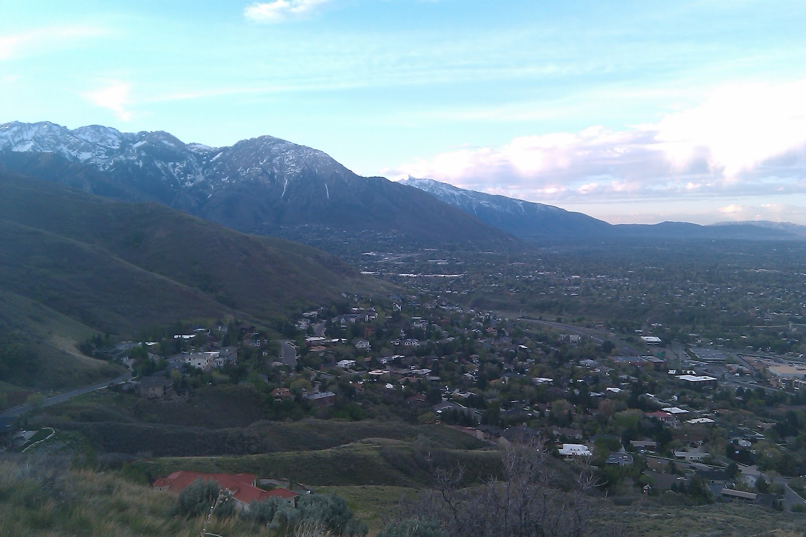
First look at the valley 

A view of Grandeur Peak to the north


The desolation trailhead is located at the South Box Elder Picnic area, 3.2 miles up the canyon just east of the Millcreek  Inn.

View Salt Lake overlook-Thayne Canyon in a larger map

Monday, April 23, 2012

Jack's Mountain Mailboxes


 In 1995 Jack Edwards died of leukemia. His parents went to a peak above Salt Lake and scattered his ashes. There are two mailboxes that mark the site, with a notebook that begins with a letter from Jack’s mother: "Please take a moment to say hello to Jackie Jack and write a little (or long) note." The mailboxes now contain several journals (we counted 14) filled with personal and poignant entries by visitors from the past.
A view to the south as we head up the rigeline

The trail starts at the Bonneville Shoreline trailhead on Lakeline Drive, southeast of the “H”Rock. Take the Shoreline Trail west about 0.3mile, just past a brown post, to a footpath that goes north into an oak grove and makes a short, steep climb to the top of the H Rock. There are several trails to the ridge above; the easiest continues northeast 500 feet to a hard right turn. Go another 500 feet to the ridge trail. Go left along the ridge to the communication tower. There, the trail goes downhill briefly and then up, up, up northeast. Jack’s Mountain peaks 1.6miles from the trailhead. The mailboxes are just north of the summit. 

A view back down the trail                                              Skittles

Writing in the journals.
Please, do not disturb the memorial except to read and write in the notebooks.
This hike offers wonderful views of the city


For directions to the trailhead click here.

View Larger Map