Tuesday, May 22, 2012

Grandeur Peak (from the west)

I have hiked Grandeur Peak many many times over the years but always from church fork. This time we attempted to access it from the west side. There are 3 main trails approaching from the  west. All three options start from the Bonneville Shoreline trail.   The option we choose starts up the ridge further to the north and closest to I-80.  

View of I-80 from along the trail.
Once the trail reaches the top of the ridge it makes a very steep climb to the south where it joins the middle trail. From the trail merge the peak is in view and the climb is very steep. Overall the trail is much more difficult than the Church Fork route. Due to the fact that I need to take too many rest stops we didn't make it all the way to the summit this time. We will have to return later to finish the job.

Beautiful wildflowers along the trail.

Joel pretending he is fat.


After making the decision to turn around we decided to come down the middle trail. This option appeared to be a little more steep and also a little shorter. I can tell you honestly me knees and thighs were quite sore after this decent.
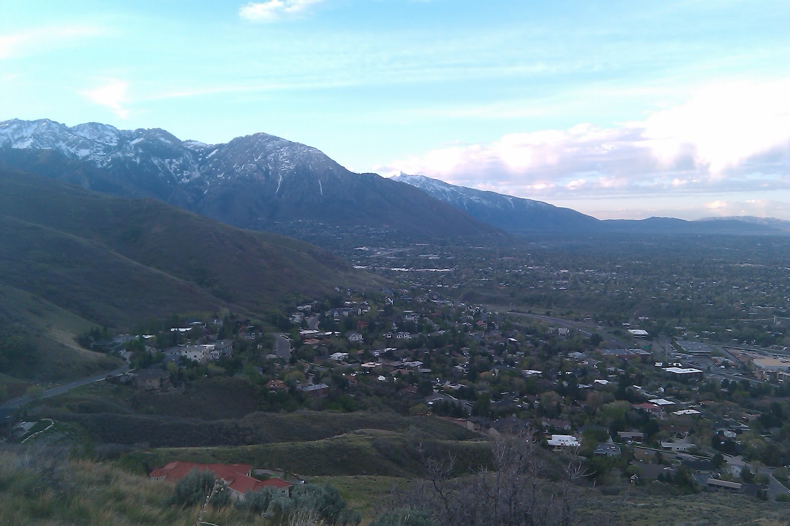
View towards downtown Salt Lake from where we turned around

Getting There:
 From the stop light at 3300 South and Wasatch Boulevard head east to stay on Wasatch Boulevard.   Wasatch Boulevard immediately turns north and parallels I-215.  Follow Wasatch Boulevard to its end where there is plenty of parking.  From the end of Wasatch Boulevard walk up the dirt road and take the first right fork.   The dirt road heads towards the mountain.  To the left (north) is the first ridge from Parleys Canyon.  In the gully formed by the first and second ridge south of Parleys Canyon, there is a well-maintained trail leading up the bottom of the gully.   This is the best route for climbing the West Ridge.  The trail follows the gully and than cuts left to the ridge top and a view of Parleys Canyon.  From the Parleys Canyon viewpoint the route is a well-used hiker made trail which follows the steep ridge to the summit.


View Grandeur-west in a larger map

Monday, May 14, 2012

Mill B North and Hidden Falls


The Mill B North Trail Starts up Big Cottonwood Canyon. About 6 miles up the canyon in the middle of the S curve is the parking area. To the South of the road is the more popular Lake Blanche trail . The Mill B North Trail head is on the North side of the road near the top of the S curve. This trail is more often uses to access Hidden falls that is just a short distance from the Road.

The trail forks almost immediately after crossing the road. The trail to the left goes to the falls and the trail to the right heads up several switchbacks to the top of the hill above the falls. From here the trail follows the stream above the falls for a little while before turning to the right and climbing slightly steeper. After two long switchbacks the trail makes its way to the first overlook above Big Cottonwood.

View up the Canyon from the canyon overlook


Joel on the trail
After the overlook the trail heads to the northeast along the ridge between the Mill B fork and Porter fork canyons. We stopped at an overlook above Porter Fork directly beneath Mount Raymond. The trail continues on and provides access to Mount Raymond and Gobblers Knob eventually making its way down the other side of the mountain into Millcreek Canyon. 

Taking a rest at the top of Porter fork.


On the way back down we stopped off at the falls. Hidden falls is truly a beauty. I wonder how many people travel up and down the canyon without ever seeing it.


View Mill B Trail in a larger map
Tuesday, May 8, 2012

Ferguson Canyon

Ferguson Canyon is a little know canyon near the mouth of Big Cottonwood Canyon. The trailhead is a little difficult to find This is the description we followed: Follow directions to the mouth of Big Cottonwood Canyon. There is a 7-11 store here, at the intersection of Wasatch Blvd (Hwy 210) and Fort Union Blvd (Hwy 190, also 7200 South). From this intersection, head south on Wasatch Blvd for a quarter mile and turn left (east) into the Prospector Drive neighborhoods. Take an immediate right and head south up the hill. Take the second left onto Timberline drive and park alongside the right side of the road near the trailhead sign. A dirt road leads to a white water tower and then turns into a trail that descends into the canyon. Follow various branching trails east into the mouth of the canyon.
View back towards the Valley from the water tower

The Trail mainly follows the stream up the canyon. The first part of the canyon is surrounded by huge rocks and boulders, I would imagine it is a popular climbing spot.


We also found many old and interesting trees along the trail.


After about 1.5 miles the trail leaves the stream and heads up the mountain to the east to an overlook spot. This is where our journey ended for the day. I believe the trail does continue up to the top of storm mountain. We may have to come back and travel to trail a little further in the future.

Joel at the overlook
This was my favorite picture of the hike, an old tree perched at the top of the lookout area.

View Ferguson Canyon in a larger map

Monday, April 30, 2012

Desolation Trail to Salt Lake Overlook


The Desolation trail is a 17.5 mile (one way) trek that starts in Millcreek Canyon and ends at Desolation lake. Although I would have loved to have hiked the whole thing time would not permit. Our destination was a Valley overlook about 2 miles from the trailhead. The trail starts to the west of  the parking area. After a short distance the trail forks with the Desolation trail heading to the right and the Thayne Canyon trail going left.


The first part of the trail is very wooded and offers a lot of shade. after about a 1/4 mile you hit the first set of switchbacks. The trail was fairly easy but had a very steady elevation gain. After the first set of switchbacks the trail heads back to Thayne Canyon where the Two trails meet up again. (We took the Thayne Canyon trail on the way down.) Desolation trail then heads west and gradually makes its way up the mountainside. There is one switchback before a longer stretch of the trail  takes you to the last set of switchbacks that takes you over the ridge line to the Valley overlook.


First look at the valley 

A view of Grandeur Peak to the north


The desolation trailhead is located at the South Box Elder Picnic area, 3.2 miles up the canyon just east of the Millcreek  Inn.

View Salt Lake overlook-Thayne Canyon in a larger map

Monday, April 23, 2012

Jack's Mountain Mailboxes


 In 1995 Jack Edwards died of leukemia. His parents went to a peak above Salt Lake and scattered his ashes. There are two mailboxes that mark the site, with a notebook that begins with a letter from Jack’s mother: "Please take a moment to say hello to Jackie Jack and write a little (or long) note." The mailboxes now contain several journals (we counted 14) filled with personal and poignant entries by visitors from the past.
A view to the south as we head up the rigeline

The trail starts at the Bonneville Shoreline trailhead on Lakeline Drive, southeast of the “H”Rock. Take the Shoreline Trail west about 0.3mile, just past a brown post, to a footpath that goes north into an oak grove and makes a short, steep climb to the top of the H Rock. There are several trails to the ridge above; the easiest continues northeast 500 feet to a hard right turn. Go another 500 feet to the ridge trail. Go left along the ridge to the communication tower. There, the trail goes downhill briefly and then up, up, up northeast. Jack’s Mountain peaks 1.6miles from the trailhead. The mailboxes are just north of the summit. 

A view back down the trail                                              Skittles

Writing in the journals.
Please, do not disturb the memorial except to read and write in the notebooks.
This hike offers wonderful views of the city


For directions to the trailhead click here.

View Larger Map

Tuesday, June 28, 2011

Beartrap Fork - Big Cottonwood Canyon


Beartrap fork is located up Big Cottonwood Canyon. to get to the trail head go east on  Big Cottonwood Canyon Rd.(7200 S.) 10.5 miles up the canyon past the spruces campground. The trail head is on the North side of the road, there is a small gate in front of an old access road, the trail starts behind the gate.
Click here for directions to the trailhead. 


The first part of the trail is a little difficult to follow it follows an old jeep trail with a couple of switchbacks and then intersects with another old jeep trail. Stay on the main path and you should make your way to the first stream crossing. We found the water running really high and fast so be careful as you cross. the trail then heads up the canyon mainly following the stream.
One of the many Stream crossings

Joel crosses an old dead tree


Ski lift from the Canyons Ski Resort in Park City

A view of Park City from a distance

A Beautiful view of the Ridge dividing Salt lake and Summit counties


View Beartrap Fork in a larger map

Tuesday, June 21, 2011

Neffs Canyon

Neffs Canyon is one of my favorite hikes.
We hiked this trail on June 21st 2011, normally most the snow would be gone by then but, due to a very wet spring, we had to do much of the hike in snow. As we usually do we began early (around 6:30) the trail is very well maintained and easy to follow. Because of all the snow and excessive runoff we had quite an adventure trying to find our way around parts of the trail that were flooded.  The hike is moderate with the last .25 mile or so becoming strenuous. Much of the hike is through the Mt. Olympus Wilderness area. We stopped at the meadow, the trail continues from there and can be a great way to explore the many trails in the wilderness area.


Total Distance: 3.4 mi 
Total Time: 2:42:06
Moving Time: 1:15:25
(one way) 6.8 miles round trip


Max Speed: 11.67 km/h (7.3 mi/h)
Min Elevation: 1685 m (5528 ft)
Max Elevation: 2385 m (7826 ft)
Elevation Gain: 876 m (2874 ft)
Max Grade: 5 %
Min Grade: -1 %
Recorded: Tue Jun 21 06:30:02 MDT 2011


View Neffs Canyon 6-21-11 in a larger map